Cavan,
Ireland
Coordinates: 54.038262, -7.051549


Coordinates: 54.038262, -7.051549

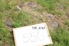
| Photo | Grave | Name | Surname |
|---|---|---|---|
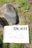 |
CV-DRGN-0526 | ||
 |
CV-DRGN-0527 | ||
 |
CV-DRGN-0528 | ||
 |
CV-DRGN-0529 | ||
 |
CV-DRGN-0530 |
|
|
 |
CV-DRGN-0531 | ||
 |
CV-DRGN-0532 | ||
 |
CV-DRGN-0533 |
|
|
 |
CV-DRGN-0534 | ||
 |
CV-DRGN-0535 | ||
 |
CV-DRGN-0536 | ||
 |
CV-DRGN-0537 |
|
|
 |
CV-DRGN-0538 | ||
 |
CV-DRGN-0539 |
|
|
 |
CV-DRGN-0540 | ||
 |
CV-DRGN-0541 | ||
 |
CV-DRGN-0542 | ||
 |
CV-DRGN-0543 |
|
|
 |
CV-DRGN-0544 | ||
 |
CV-DRGN-0545 | ||
 |
CV-DRGN-0546 | ||
 |
CV-DRGN-0547 | ||
 |
CV-DRGN-0548 | ||
 |
CV-DRGN-0549 | ||
 |
CV-DRGN-0550 |

![]()
This survey was conducted as part of a community heritage project funded by Cavan County Council & the Heritage Council and community liaison was by Architectural Recording & Research (AR&R www.arr.ie).
Drumgoon Hill survey is a later element of a highly detailed community survey designed and overseen by Mr Kevin Barton of www.lgs.ie.