Stories

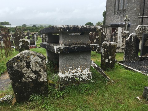
This graveyard and ruined church are located in the townland of Barrysfarm, in the parish of  Hospital and Herbertstown, and in the barony of Smallcounty. The site is located on the northern end of the town of Hospital, west of the Main St. The river Mahore flows immediately to the north.
 
The site is composed of the 19th century Roman Catholic Church, dedicated to st. John The Baptist, the Medieval church ruins and the adjoining graveyard. The Roman Catholic Church was built in 1852 in a Gothic revival style.
This church and graveyard are in the townland of Ballingaddy North, in the parish of Kilmallock/Ballingaddy and in the barony of Coshlea. The site is located immediately south of Ballingaddy Catholic Church, about 1.5 km south-east of Kilmallock town, on the L1535, off R512 road to Ardpatrick. The river Loobagh flows north-east of the graveyard.
 
The ruins of the church are in the north west section of the graveyard.
Close to the heart of Kilmallock town lies the ruins of Kilmallock Collegiate Church and Graveyard, dedicated to St. Peter and St. Paul. It is located in the townland of Deebert, in the parish of Kilmallock/Ballingaddy, in the Barony of Connello Upper. The ruins are located on the south bank of the Loobagh River, on Orr’s St., north of the town’s main street.
 
The graveyard which surrounds the church is sub-rectangular in shape and measures 63m N-S x 78m E-W. It is enclosed by a post-1700 stone wall.
This ruined church and adjoining graveyard are in the townland of Tankardstown South and part of the parish of Tankardstown, in the barony of Coshma. The name Tankardstown translates to ‘Baile Thancaird‘ , the Town of Tancard, Tancard being a personal name (Logainm.ie).
This graveyard is located in the townland of Ballynoe, in the parish of Bruree and in the barony of Connello Upper. It stands on high ground, overlooking the Maigue River and the village of Bruree lies to the north and east.
The graveyard surrounds the Church of Ireland church. It is dedicated to St. Munchin who is the patron saint of Bruree, (feast day 2nd January). It is a Board Of First Fruits Church which was built in 1812, and possibly on the site of a medieval church which had also been dedicated to St.
The ruined church and adjoining graveyard are in the townland of Dromin South, in the parish of Athlacca/Dromin, in the barony of Cushma. The townland is North of Kilmallock Town, west of the R512. The graveyard is located 4.5km east of Bruree, on the L1550, and southwest of Dromin village. The name Dromin can be translated as Dromainn meaning ‘a high ridge of land’(Logainm.ie).
 
The medieval church ruins, also dedicated to the Holy Trinity since the 15th century, stands in the middle of an almost square graveyard, measuring 87m NW-SE x 81m NE-SW.
This Church of Ireland Church and adjoining Graveyard are in the townland of Athlacca South and part of the Dromin/Athlacca parish, in the barony of Cosma. The church and graveyard are located in the village of Athlacca, south of the Morning Star river. This river flows into the Maigue River immediately west of the townland and west again is the N20 route Charleville to Limerick City. The graveyard can be located by heading east from the village of Bruree on the R518, taking the first road to the left.
This graveyard is in the townland of Garryhintogue, in the civil parish of Doneraile and in the barony of Fermoy.
 
It is located east of the town of Buttevant, in a bend of the Ogeen River, a tributary of the Awbeg River. It is east of the R522 road.
 
It is approached by a short passage from the road to the west. It is sub-rectangular in shape and is enclosed by an overgrown stone-faced earthen bank. The ruins of a parish church, probably late medieval in date, are located in the centre of the graveyard.
This graveyard is in the townland of Ballynadrideen, in the civil parish of Ballyhay and in the barony of Orrery and Kilmore.
 
This small graveyard is located to the west of Ballyhay and the N20 Charleville to Buttevant road. It is in flat, poorly-drained land and approached by crossing a field. It is in fact two adjoining graveyards, orientated in an east/west direction. Both are enclosed by low, worn, earthen banks. There are ruins of a church in the western end of the western graveyard.
This is the Catholic Church in Mitchelstown. It is in the townland of Brigown, in the parish of Mitchelstown and in the barony of Fermoy.
 
It is located on Church Hill off the east side of Main St. in Mitchelstown and overlooks New Market Square. To the west of the church lies the d-shaped graveyard. It is enclosed by a stone wall on the west side. Elsewhere it is bounded by a low curving stone wall topped by iron railings. There are stone piers at the entrance. Memorials in the graveyard date from the 19th century to present.

Pages