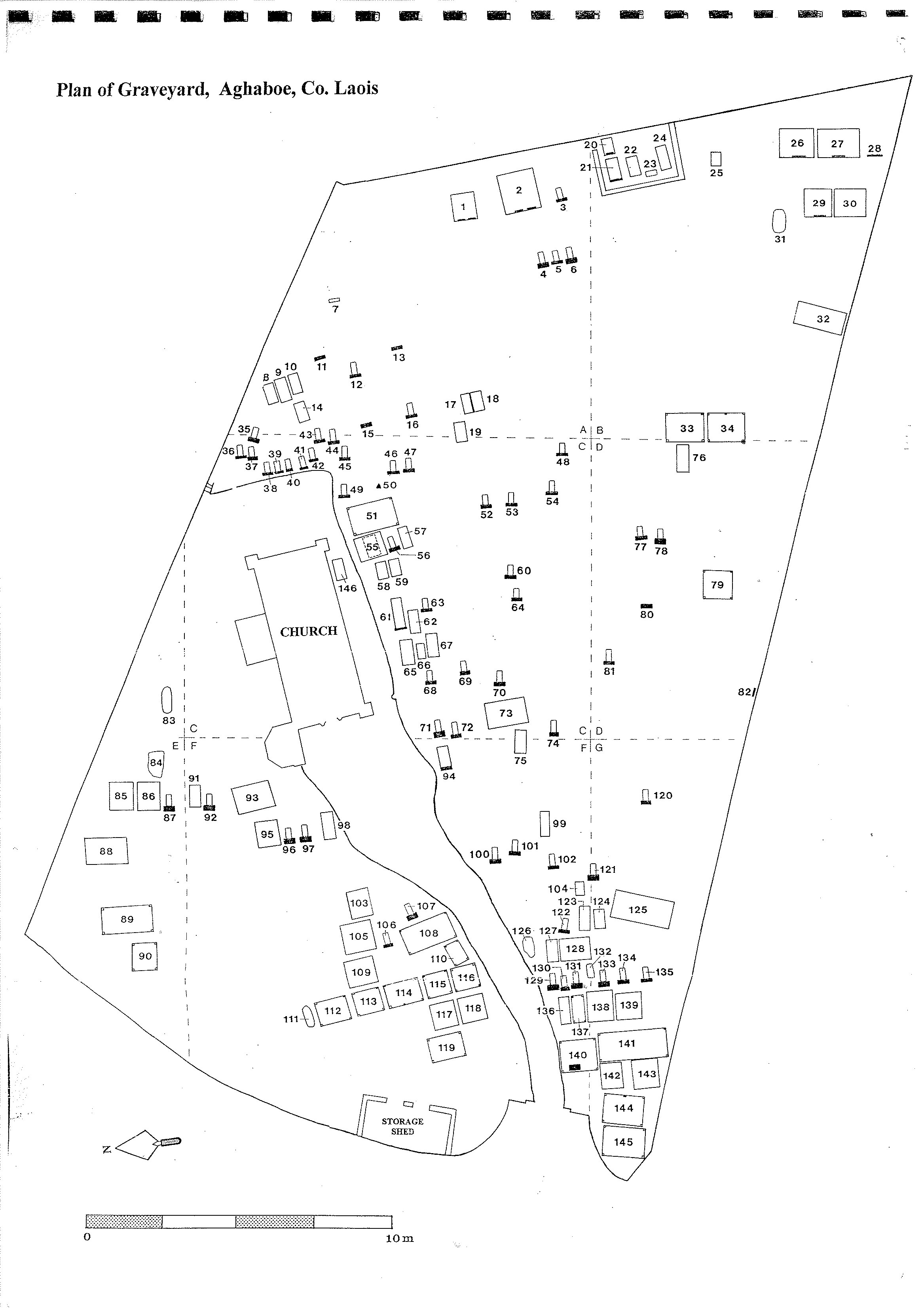
Aghaboe,
Laois,
Ireland
Coordinates: 52.922139, -7.512932
Description

Project:
Coordinates: 52.922139, -7.512932

| Photo | Grave | Name | Surname |
|---|---|---|---|
|
|
LA-AGHG-001 |
|
|
|
|
LA-AGHG-002 |
|
|
|
|
LA-AGHG-003 | ||
|
|
LA-AGHG-004 |
|
|
|
|
LA-AGHG-005 | ||
|
|
LA-AGHG-006 |
|
|
|
|
LA-AGHG-007 |
|
|
|
|
LA-AGHG-008 | ||
|
|
LA-AGHG-009 | ||
|
|
LA-AGHG-010 | ||
|
|
LA-AGHG-011 |
|
|
|
|
LA-AGHG-012 |
|
|
|
|
LA-AGHG-013 |
|
|
|
|
LA-AGHG-014 |
|
|
|
|
LA-AGHG-015 |
|
|
|
|
LA-AGHG-016 |
|
|
|
|
LA-AGHG-017 | ||
|
|
LA-AGHG-018 | ||
|
|
LA-AGHG-019 | ||
|
|
LA-AGHG-020 |
|
|
|
|
LA-AGHG-021 | ||
|
|
LA-AGHG-022 | ||
|
|
LA-AGHG-023 | ||
|
|
LA-AGHG-024 | ||
|
|
LA-AGHG-025 |
The graveyard is in rural area with pasture land surroundings, in the small village of Aghaboe; northeast of the Aghaboe Priory.
Located within site of RMP (LA022-019- ecclesiastical site).
Graveyard contains a Church of Ireland church (built 1818), marked on 1841 OS map as 'Church' and 'Grave Yard' with 'R.C. Chapel in ruins' nearby.
Graveyard contains headstones dating from 18th to 21st century; mainly upright; some celtic crosses; five altar tombs.
Graveyard stone wall boundary in good condition, 1.5-2m high; small amount of ivy some places; gate access and gravel path. Located beside roadside. Ground surface is level.