Sweetman, P.D., Alcock, O. & Moran, B. (1995) Archaeological inventory of County Laois. Dublin. Dublin Stationary Office, 88
O'Hanlon, J. Rev. & O'Leary, E. Rev. (1907) History of the Queen's County. Sealy, Bryers and Walker, vol 1 315-6
O'Flanagan, Rev. M. (1933) Letters containing information relative to the antiquities of the Queen's County collected during the progress of the Ordnance Survey in 1838 (John O'Donovan's Letters), Ordnance Survey of Ireland
Record of Monuments & Places, Co. Laois compiled by Caimin O'Brien (2007)
Redmond, N.T. (1997) Grave Inscriptions, Killeshin, Sleaty, Graiguecullen, Mayo, Arles, Doonane, Castletown, Rathaspick, Shrule, Rathnure etc., with Historical Notes, Rosmore Killeshin Development Association (RKDA), 11, 72
Journal of the Association for the Preservation of the Memorials of the Dead, Ireland, 'Queen's County', (1895) 134-145, (1904) 138-9
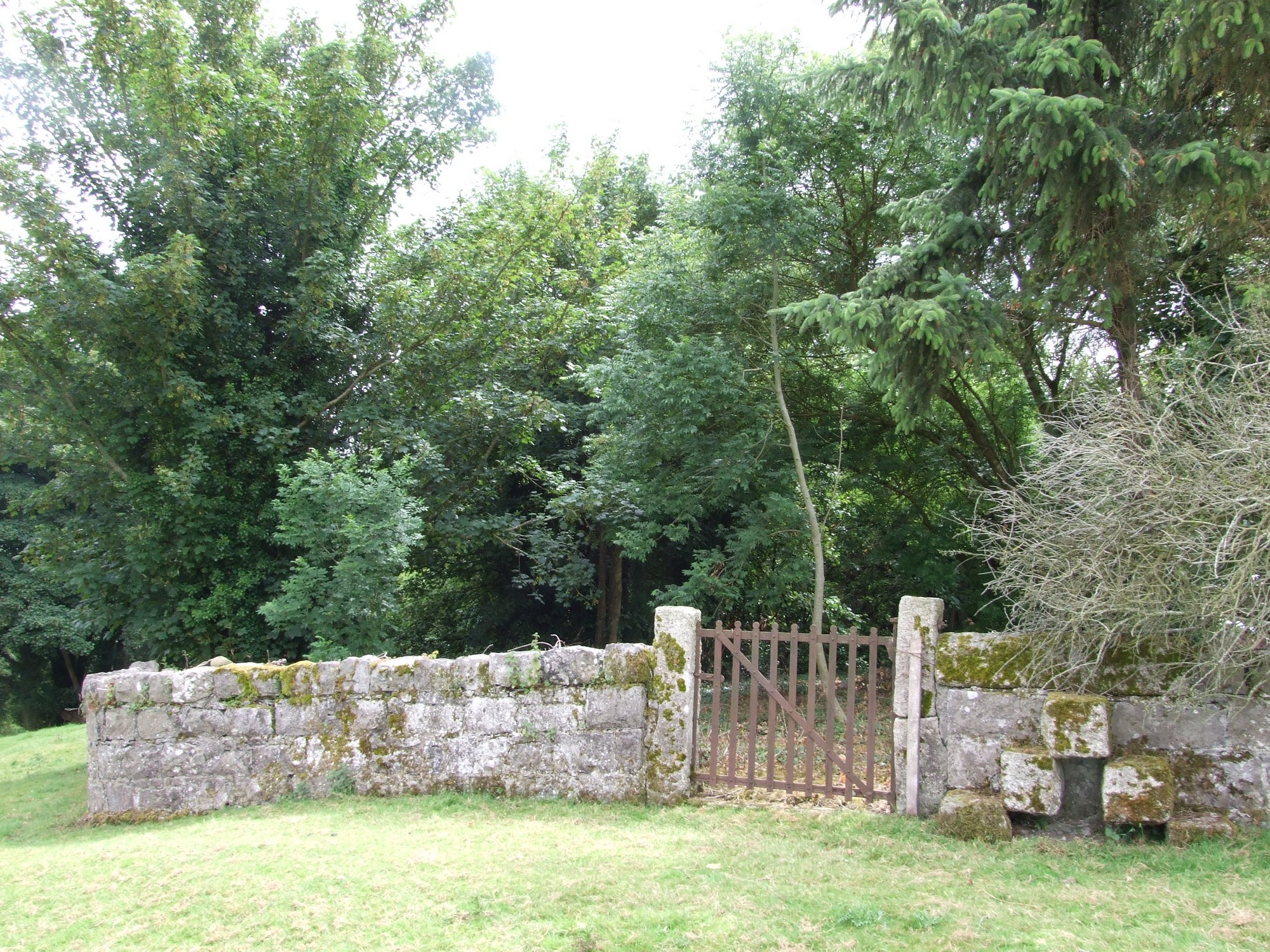


The graveyard is in rural area, in farmland associated with Shrule Castle (LA032-012001).
Site of graveyard contains no upstanding church structures. Marked on 1841 OS map as 'Grave Yard' and on 1908 OS map as 'Burial Ground (disused). Reference to ruins of an 'old chapel' in a graveyard to N of 'Shrule Castle'. No visible remains of 'old chapel'.
Site of graveyard contains no headstones or markers. There are some inscribed stones associated with the ruins of the castle.
Graveyard has rectangular shape measuring approx. 44m north-south by 47m east -west; it has limestone block boundary wall, and an earthen bank along the inside of the west boundary. No paths; ground is overgrown.