Sweetman, P.D., Alcock, O. & Moran, B. (1995) Archaeological inventory of County Laois. Dublin. Dublin Stationary Office, 77
Manning, C. (1998) 'Cross-slabs from Clonenagh, Co. Laois'. In Manning (ed.), Dublin and beyond the Pale : studies in honour of Patrick Healy , Wicklow, Wordwell. 185-192
Comerford, Rev. M. (1886) Collections relating to the Dioceses of Kildare and Leighlin. Dublin, Duffy, vol 3, 291-8
O'Hanlon, J. Rev. & O'Leary, E. Rev. (1907) History of the Queen's County. Sealy, Bryers and Walker, vol 1 209
Record of Monuments & Places, Co. Laois compiled by Caimin O'Brien (2007)
Journal of the Association for the Preservation of the Memorials of the Dead, Ireland, 'Queen's County', (1910) 153-156, (1926-31) 283-290
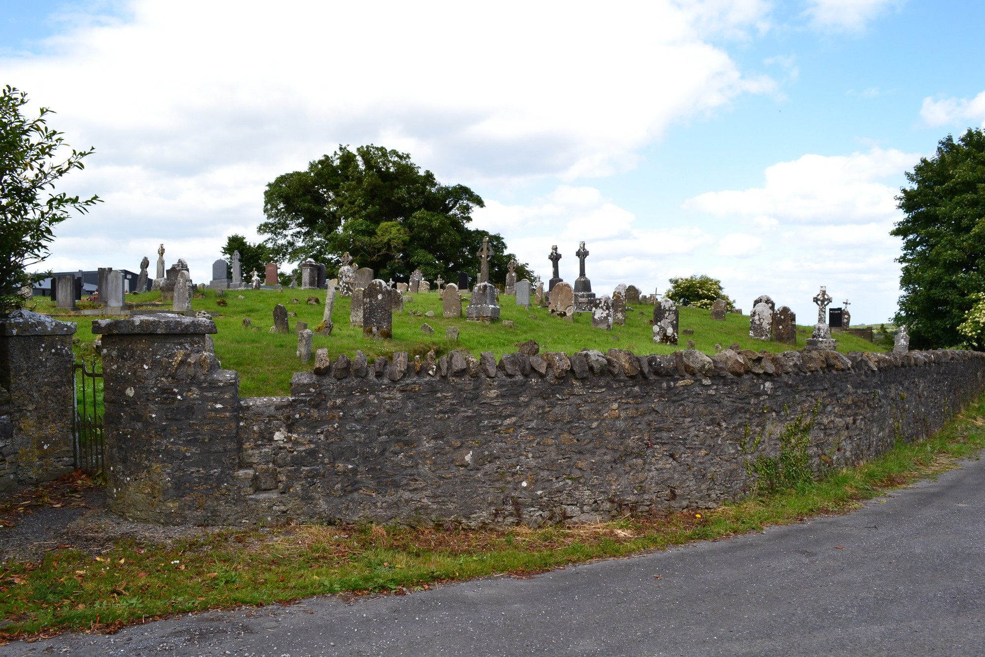


The graveyard is in rural area, on low rise, surrounded by undulating pasture land. Two other graveyards are also located within the townland of Clonenagh, one (St Bridget's) across road and fields to south and one (St Fintan's) across the road to southwest.
Graveyard contains no structural remains; marked on 1841 OS map as 'Graveyard'. During a cleanup of graveyard in 1988 thirteen inscribed early Christian cross-slabs were discovered. The site of the monastery of Clonenagh (founded by St Fintan c. 548) is located c. 200m southwest across the road at Church of Ireland graveyard of St Fintan's. A holy well site dedicated to St Fintan is located adjacent.
Graveyard contains 18th to 20th century headstones, in good condition; including celtic crosses, metal crosses, rounded, recumbent headstones and table tombs. Some small uninscribed stone markers are evident within the graveyard. The early Christian cross-slabs discovered in 1988 have been set against the wall inside gate.
Graveyard has irregular shape; boundary stone wall, intact, c. 1.5-2m high; access via gate and stile from roadside. Short length of path inside gate. Ground higher within graveyard than without. Graveyard maintained and grass regularly mown.