Tipperary,
Ireland
Coordinates: 52.608781, -7.642536
Summary
Graveyard Code:
TS-GGBL
RMP/Site number:
TS048-042004-
Townland:
Glengoole South
County:

Coordinates: 52.608781, -7.642536
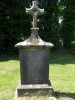
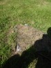
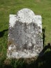
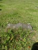
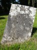
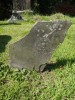
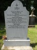
| Photo | Grave | Name | Surname |
|---|---|---|---|
 |
TS-GGBL-0001 | ||
 |
TS-GGBL-0002 | ||
 |
TS-GGBL-0003 | ||
 |
TS-GGBL-0004 | ||
 |
TS-GGBL-0005 | ||
 |
TS-GGBL-0006 | ||
 |
TS-GGBL-0007 |
|
|
 |
TS-GGBL-0008 |
|
|
 |
TS-GGBL-0009 | ||
 |
TS-GGBL-0010 |
|
|
 |
TS-GGBL-0011 | ||
 |
TS-GGBL-0012 | ||
 |
TS-GGBL-0013 | ||
 |
TS-GGBL-0014 | ||
 |
TS-GGBL-0015 |
|
|
 |
TS-GGBL-0016 | ||
 |
TS-GGBL-0017 | ||
 |
TS-GGBL-0018 |
|
|
 |
TS-GGBL-0019 |
|
|
 |
TS-GGBL-0020 |
|
|
 |
TS-GGBL-0021 | ||
 |
TS-GGBL-0022 | ||
 |
TS-GGBL-0023 | ||
 |
TS-GGBL-0024 | ||
 |
TS-GGBL-0025 |

![]()
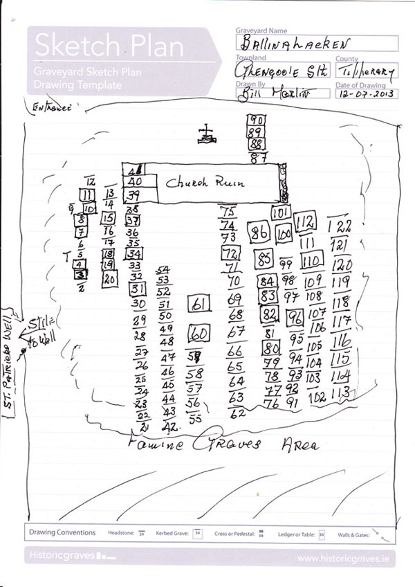


BALLINALACKEN
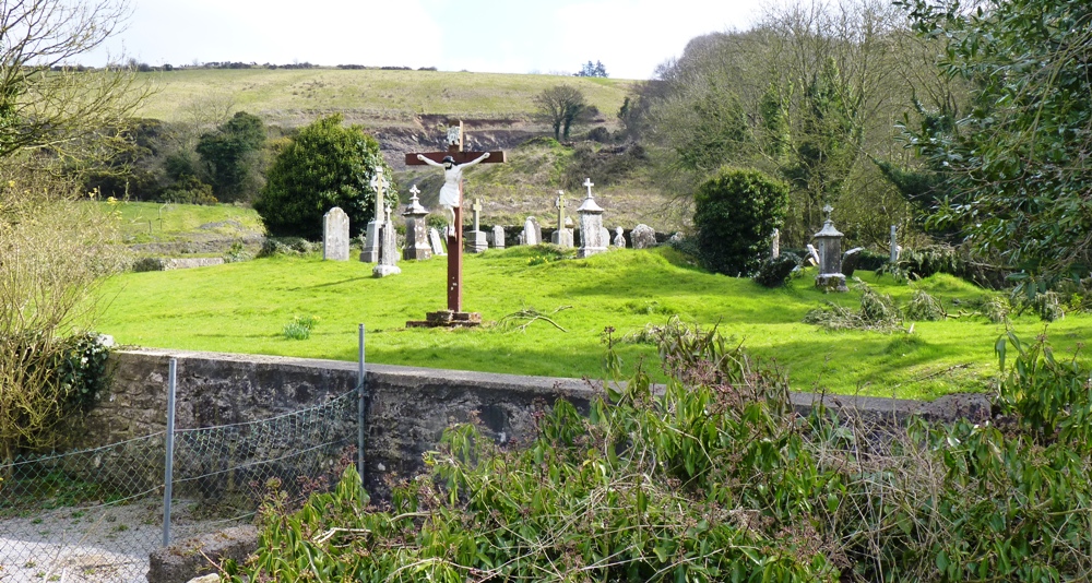
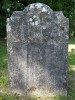
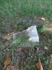
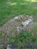
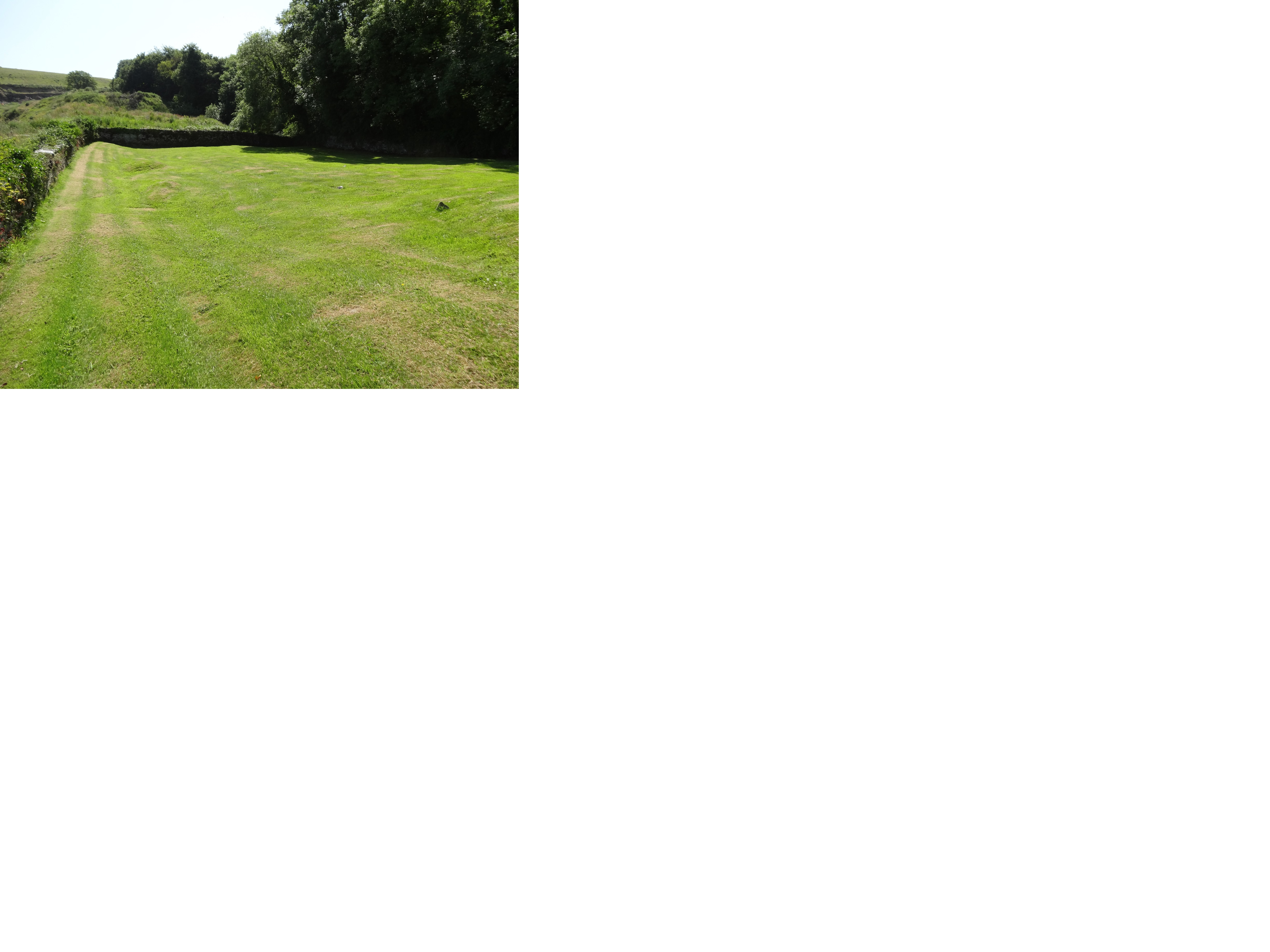
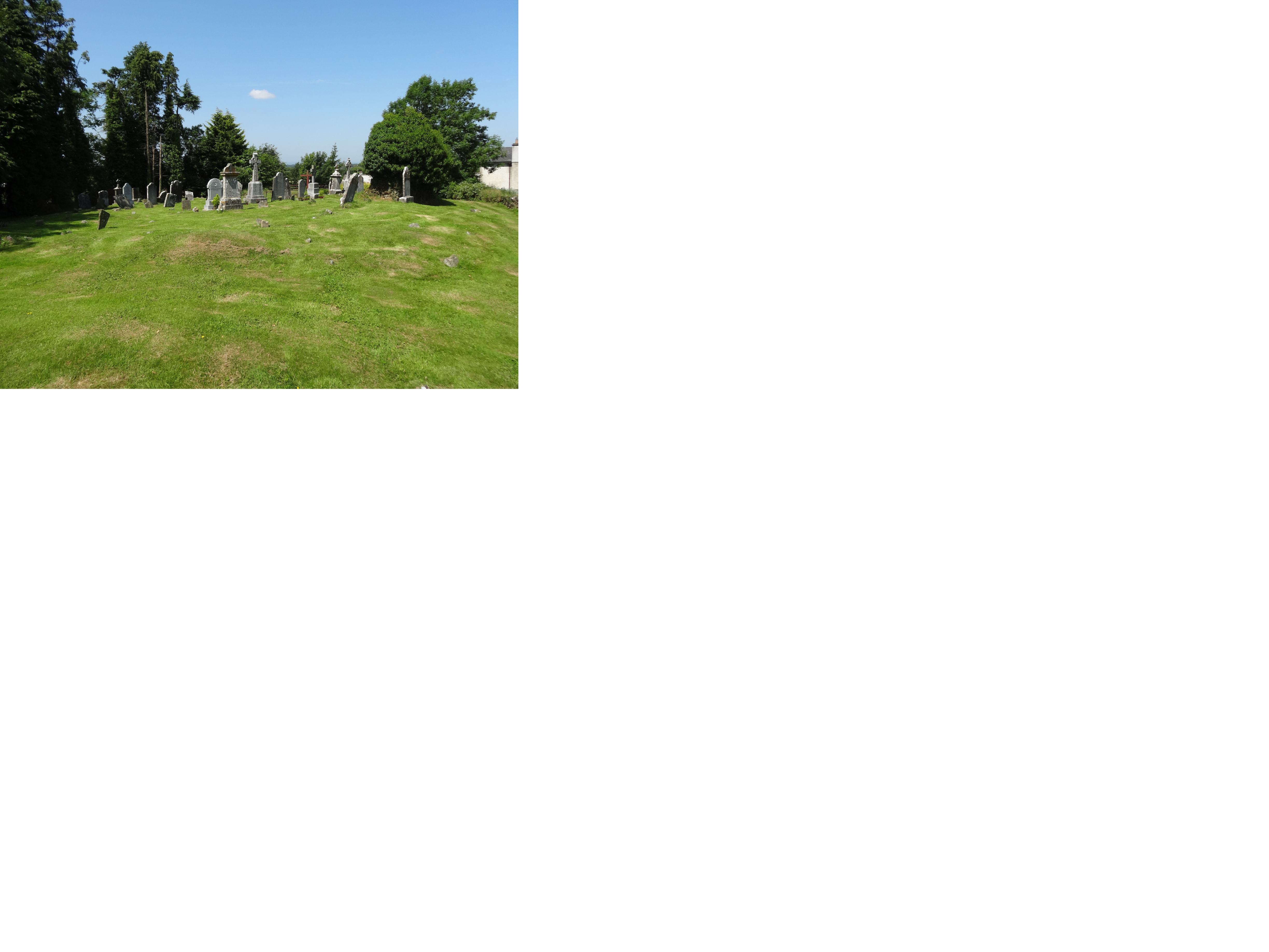
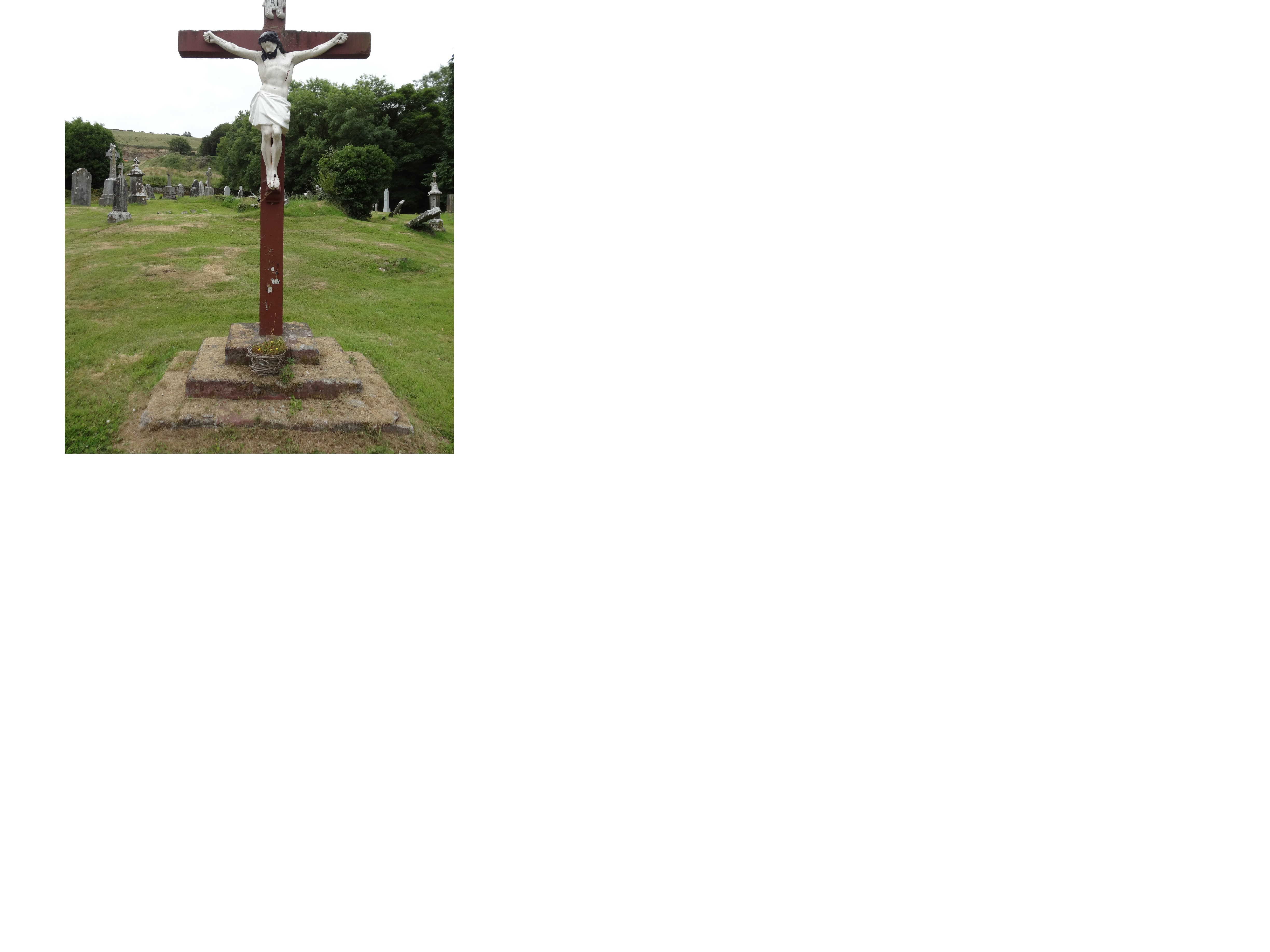
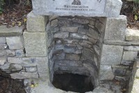
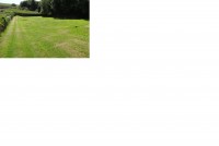
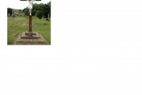
Description: On a NW-facing slope of the Slieveardagh hills with higher ground to the S and E and good views of lower ground to the NW and W. Nearby St Patrick's Well (TS048-042003-) is to the S of the church, just across a stream running along the S wall of the graveyard (TS048-042002-) (L 80m; Wth 20m). Only half of the E gable (ext. dims. L. 4m; wall T 0.8m; H 3m; int. L 2.2m), the lower wall-footings (H 0.6m) of the S wall (ext. dims. L 17m) and W gable ( ext. dims. L. 5.8m; H 1.8m) of remain of a simple rectangular church (approx. dims. ext. 7m N-S; 17m E-W) built of roughly coursed limestone rubble. Nothing visible remains of the N wall of the church. The graveyard is enclosed by a roughly coursed limestone wall (H 1.2m ; wall T 0.45m), with 18th and 19th-century headstones inside and to the S of the church, but no grave-markers in the SE quadrant. Two architectural fragments (TS048-042004-) from the church, a chamfered jamb stone with a glazing-bar hole from a window and the central head of a twin-light limestone window with decoration on its external face in the form of a marigold pattern within an incised circle, is located SW of the church, have been re-used as grave-markers. The latter may have been from the original E window of the church, and is locally believed to be the grave-marker of a pauper's grave. According to the papal letters, Ballinlacken church was vacant in the year 1491 (McCormack 1989, 14).
Compiled by: Jean Farrelly
Date of upload: 26 August 2011
The Settlement and Architecture of Later Medieval
Slieveardagh, County Tipperary.
Richard Clutterbuck
Volume II of II
This thesis is presented in fulfilment of the regulations for the degree of M.Utt
in Archaeology, University College Dublin.
Head of Department:
Supervisors:
Prof. Barry Raftery
Dr. Tadhg O'Keeffe
Dr. Muiris 0'Sullivan
August 1998
1 - Ballenlackey Church (Ballinalacken)
Glengoole South Td., Kilcooly Pr.
48/l6
S 242 508
Tl 048-0420 I
10/1997
Location Glengoole South is situated in the mid west of the study area straddling the
escarpment from the hills to the northern lowlands (Fig. 32). This was a detached part of
the parish of Kilcooly, 8.4km south west of Kilcooly Abbey (31). The church is sited at an
altitude of 150 metres at the mouth of a small stream valley in the escarpment. Glengoole
South or Ballenlackey church (1) and its associated grave-yard are sited on a level platform
in generally sloping ground. The site is adjacent to the main road which skirts the
escarpment and is also adjacent to a small stream from the escarpment.
History At the close of the fifteenth century a Papal mandate recorded that Dermot
Obagay held the vicarage of Ballenlackey church for a number of years before 1491 after
which the vicarage was given to Gerald Vhyte. Ballenlackey church was then valued at 12
marks per annum (Cal. Papal Regis. xiii, 395-396). The vicarage of St. Mary's church
Ballenleaghy was recorded as being absent in 1507 (Cal. Papal Regis. xiii, 505). The
church again appears in 1540 at the dissolution of Kilcooly Abbey when it is recorded as
the rectory or chapel of Ballenlackey which owed a portion of its tithes of grain and church
altarage income to Kilcooly Abbey. The church was worth six pounds but had been
reduced to 60 shillings after rebellions by the Cavanaghs and other Irish (Extents Ire. Mon.
Possession, 323).
Description Glengoole South church will be referred from here on as Ballenlackey
Church. The only upstanding remains of Ballenlackey church are a portion of the east wall
and the south west corner with the bottom courses of portions of the west and south walls.
The church was built of uncoursed roughly faced stone. No diagnostic remains of the
original church survive with the possible exception of two curved pieces of stone in a pile
of stones against the interior of the east wall which may be the remains of a window.
Ballenlackey graveyard is surrounded by a modern stone wall with an access path to the
main road. The grave yard is still in use and graves have been dug in the interior of the
medieval church. The modern grave yard is larger then the original and extends further
south east. The original grave yard is represented by a raised area within the modern grave
yard. A holy well dedicated to St. Patrick is situated in the next field to the south of the site
across the stream, although it does not appear to be still in use.
Comment Ballenlackey church was a chapel serving the detached portion of Kilcooly
Parish. The remains of the church are not datable however the historical record allows a
general dating frame of the thirteenth to the fifteenth centuries. It appears to have acted as a
chapel of ease for the community connected to Kilcooly Abbey.