Sweetman, P.D., Alcock, O. & Moran, B. (1995) Archaeological inventory of County Laois. Dublin. Dublin Stationary Office, 89
O'Hanlon, J. Rev. & O'Leary, E. Rev. (1907) History of the Queen's County. Sealy, Bryers and Walker, vol 1 243, 375
O'Byrne, D. (1856) 'The history of the Queen's county: containing an historical and traditional account of its foundries, duns, and other antiquities, also an account of some noble families of English extraction'. Dublin, John O'Daly, 39-40
Gwynn, A. & Hadcock, R. N. (1970) 'Medieval Religious Houses: Ireland: with an appendix to early sites'. Longmans, 45
Barrow, G.L. (1979) 'The Round Towers of Ireland: a study and gazetteer'. Academy Press, 135-9
Harbison, P. (1970) 'Guide to the national monuments in the Republic of Ireland: including a selection of other monuments not in state care'. Gill & Macmillan, 141
Crawford, H.S. (1924) 'The round tower and castle of Timahoe'. Royal Society of Antiquaries, 31-42
Record of Monuments & Places, Co. Laois compiled by Caimin O'Brien (2007)
Cosby, A., Chairperson, (1989?) Stradbally, Co. Laois, Stradbally Historical Project, J.P.F. Laois, 110-114
National Inventory of Architectural Heritage (NIAH), Co. Laois (1997)


The graveyard is in urban area, in the village of Timahoe.
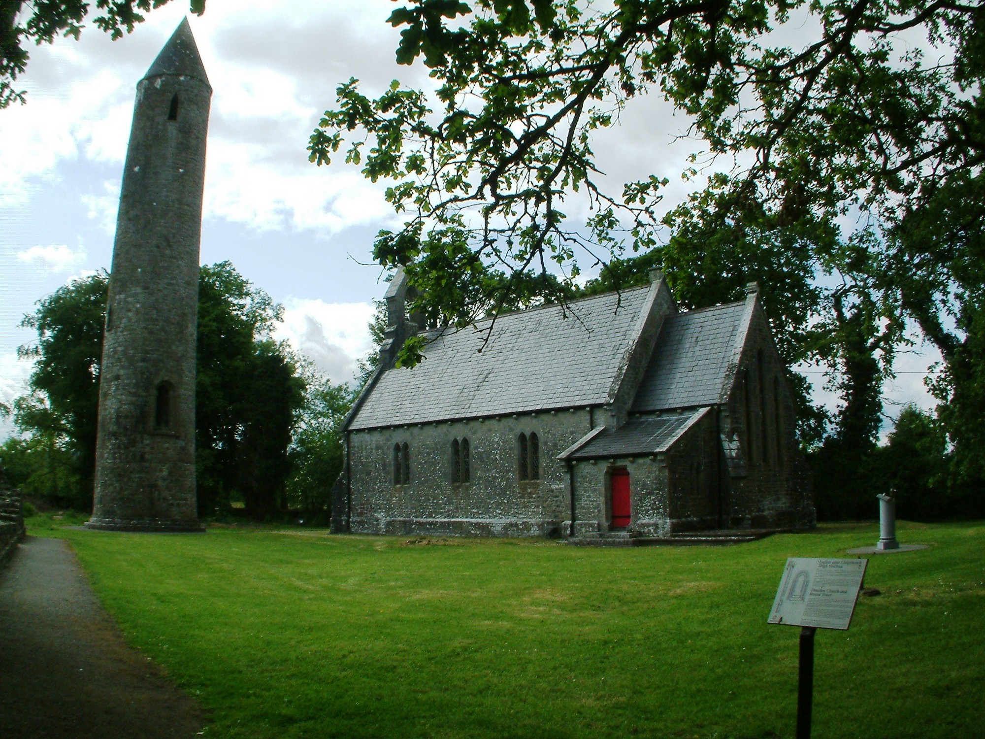
Reference to a church founded by St. Mochua (died 657); no visible surface remains. Graveyard contains ruins of a round tower which is only remains of the early monastery foundation; a 15th century church was later transformed into a towerhouse of which only a large arch survives today; a Church of Ireland church is located in the north quadrant of site, turned into library. Area on 1841 OS map marked as 'Timahoe Abbey (in ruins)' and 'Timahoe Round Tower' and on 1908 OS map as 'Church', Grave Yard', 'Round Tower' and 'Castle (in ruins) on site of Abbey'. (National Monument No. 114)
Graveyard contains 19th to 21st century headstones; newer ones in good condition, older ones leaning and damaged.
Graveyard has D- shape; boundary stone wall intact with some ivy coverage, tree boundaries in good condition. Gravel path leads to and around library, and gravel path around ruins. Ground surface generally level, but area around older graves overgrown. Ground partially well maintained; grass mown regularly.