
Ballydehob,
Cork,
Ireland
Coordinates: 51.545201, -9.469721
Summary
Graveyard Code:
CO-STUK
RMP/Site number:
CO140-050003-
Townland:
Stouke
County:
Number of Memorials:
80
Description
Project:
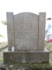
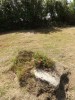
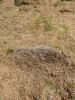
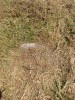
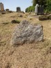

Rectangular graveyard enclosed by stone wall. Contains a ballaun stone (CO140-050002-) and the possible site of the first parish church of Schull (CO140-050003-) . Graveyard marked as "Killeenstouke Grave Yard" on OS 1st edition map (1842).