National Inventory of Architectural Heritage code:
Register of Burials available:
Location of Published Local References:
Location of Inscriptions:
Titles of Published Local References:
Sweetman, P.D., Alcock, O. & Moran, B. (1995) Archaeological inventory of County Laois. Dublin. Dublin Stationary Office, 81
Carrigan, W. (1905) The history and antiquities of the diocese of Ossory. Dublin. Sealy, Bryers & Walker, vol 2 347-8
O'Hanlon, J. Rev. & O'Leary, E. Rev. (1907) History of the Queen's County. Sealy, Bryers and Walker, vol 1 305
Record of Monuments & Places, Co. Laois compiled by Caimin O'Brien (2007)


The graveyard is in rural area, surrounded by pasture land.
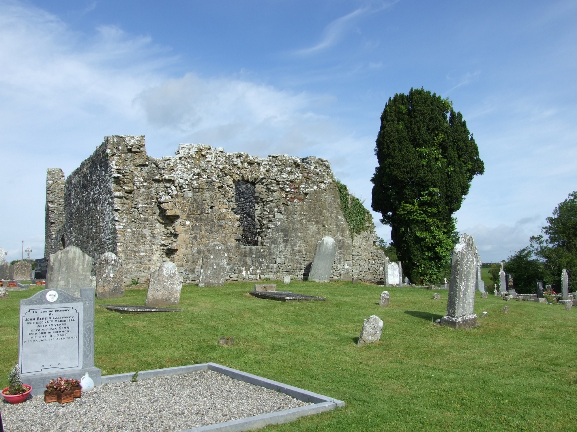
Graveyard contains ruins of medieval church marked on 1841 OS map as 'Church (in ruins)' and on 1908 OS map as 'St Kieran's Church (in ruins)'. Ruins consist of upstanding walls, measuring c. 17m by 9m (National Monument No. 113). In vicinity is the site of St Kieran's Monastery c. 200m northwest, a 17th century wayside cross c. 75m southwest, the site of St Kieran's Holy Tree c. 120m north and St Kieran's Holy Well c. 500m east.
Graveyard contains 18th to 21st century headstones, celtic crosses and recumbent slabs; mainly upright, some leaning, collapsed or damaged. A large number of small uninscribed markers are arranged in rows.
Graveyard has irregular shape; boundary defined by stone wall c. 1m high, intact. Access through gates from roadside. Gravel path leading from gate to modern graveyard annex to south. Ground surface mainly level. Ground maintained and grass regularly mown.
Some grave memorial photographs can be found here (http://www.from-ireland.net/photographs/thumbnails.php?album=9)