Sweetman, P.D., Alcock, O. & Moran, B. (1995) Archaeological inventory of County Laois. Dublin. Dublin Stationary Office, 76
Manning, C. (1998) 'Cross-slabs from Clonenagh, Co. Laois'. In Manning (ed.), Dublin and beyond the Pale : studies in honour of Patrick Healy , Wicklow, Wordwell. 185-192
Comerford, Rev. M. (1886) Collections relating to the Dioceses of Kildare and Leighlin. Dublin, Duffy, vol 3, 291-8
O'Hanlon, J. Rev. & O'Leary, E. Rev. (1907) History of the Queen's County. Sealy, Bryers and Walker, vol 1 209
Record of Monuments & Places, Co. Laois compiled by Caimin O'Brien (2007)
Journal of the Association for the Preservation of the Memorials of the Dead, Ireland, 'Queen's County', (1910) 153-156, (1926-31) 283-290


The graveyard is in rural area, surrounded by undulating pasture land. Two other graveyards are also located within the townland of Clonenagh, one (St Bridget's) across fields to east and one (Catholic) across the road to northeast .
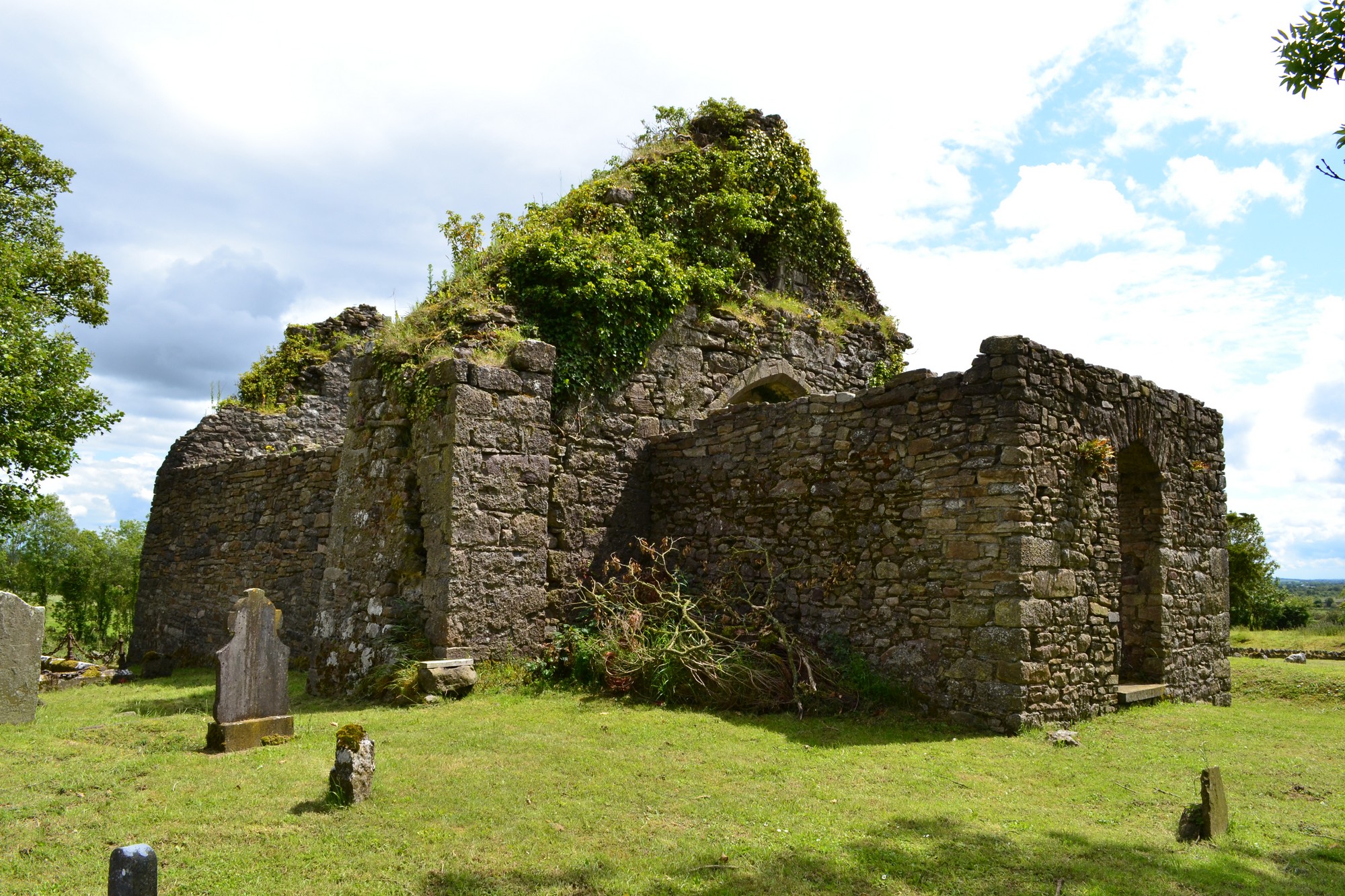
Graveyard contains ruins of late medieval church, marked on 1841 OS map as 'Church (in ruins)'. The church ruins (measuring c. 9m by 9m) consist of chancel with arch and portion of nave. Graveyard located on site of the monastery of Clonenagh founded by St Fintan c. 548. During a cleanup of Catholic graveyard across the road in 1988 thirteen inscribed early Christian cross-slabs were discovered. A holy well site dedicated to St Fintan is located c. 200m east.
Graveyard contains 18th to 20th century headstones, in good condition; including celtic crosses, metal crosses, rounded, recumbent headstones and table tombs. Rows of small uninscribed stone markers are evident within the graveyard.
Graveyard has irregular shape; boundary stone wall, intact, c. 1.5-2m high; access via gate and stile from roadside. No paths; ground higher within graveyard than without. Graveyard maintained and grass regularly mown.