Laois,
Ireland
Coordinates: 52.957000, -7.190000
Summary
Graveyard Code:
LA-FSLW
RMP/Site number:
LA019-016001; LA019-016002
Townland:
Fossy Lower
County:
Description
Project:

Coordinates: 52.957000, -7.190000

![]()
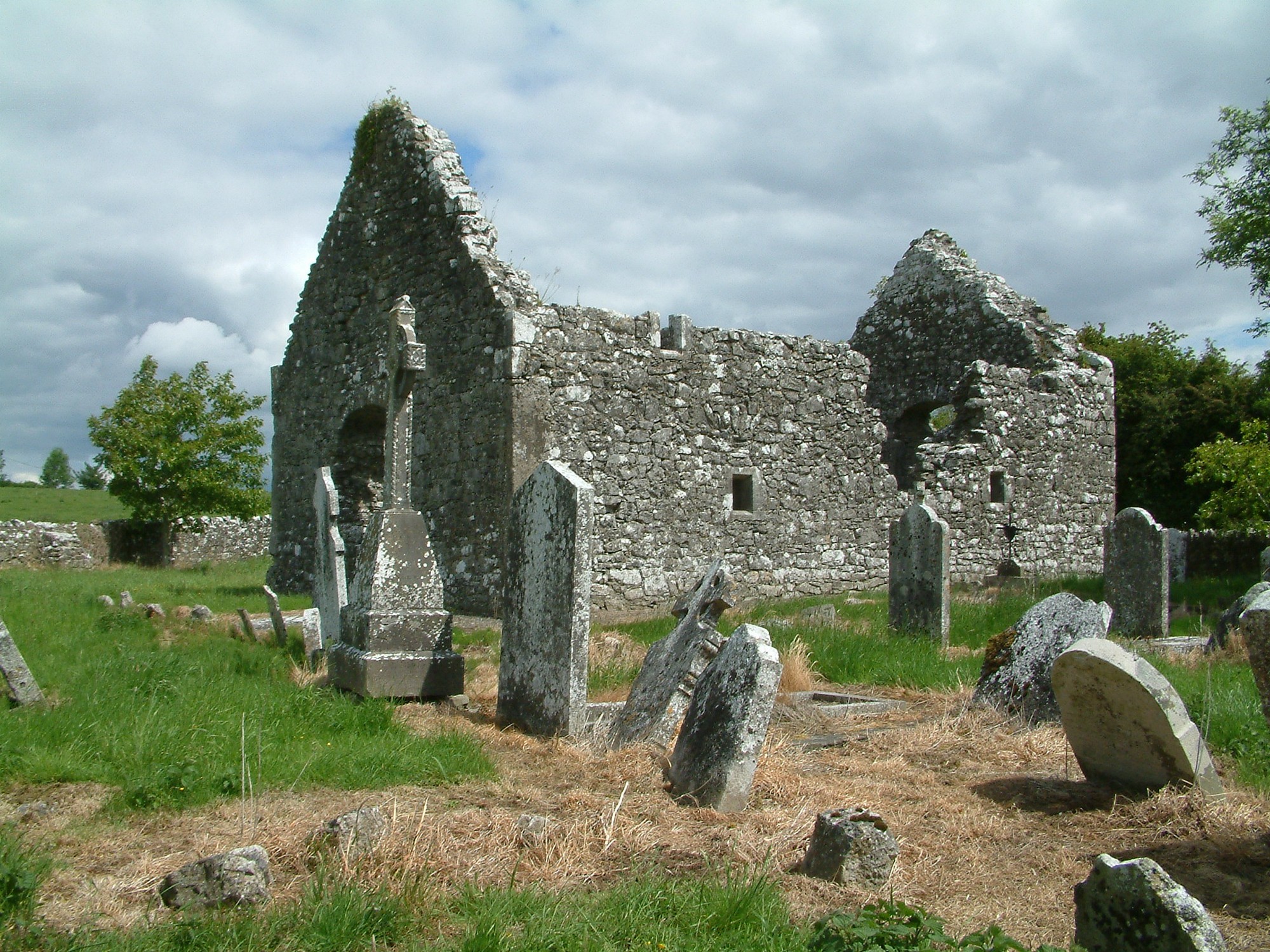
The graveyard is in rural area, surrounded by pasture land, southeast of village of Timahoe. The site is marked on 1841 OS map as 'Fossy Church (in ruins)'. Graveyard has irregular shape; boundary defined by stone wall, 53m north to south, 33m east to west and c. 1-1.5m high, intact. There is a gate and stile located in the northeast corner. Access across fields through gate and stile. No paths. Ground surface uneven due to concealed features. Ground level higher within graveyard than without. Ground maintained and grass regularly mown.
Graveyard contains ruins of late medieval church with upstanding walls and gables with door and window opes, measuring c. 14m by 8m (part of National Monument No. 114; see Timahoe). The church was rebuilt or remodelled in 1608. The church is located in the northeast quadrant of the graveyard. The church building repaired by OPW in 1945.
Graveyard contains 18th to 20th century headstones, celtic crosses and recumbent slabs; mainly upright, some leaning, collapsed or badly worn. The earliest inscribed memorial is to Michael Walfh (Walsh) and possibly dates to 1612. Early Christian cross slab inscribed with 19th century initials, found during late 20th century graveyard cleanup scheme.However, this was not located in the present survey.