Register of Burials available:
Location of Published Local References:
Titles of Published Local References:
Sweetman, P.D., Alcock, O. & Moran, B. (1995) Archaeological inventory of County Laois. Dublin. Dublin Stationary Office, 78
Comerford, Rev. M. (1886) Collections relating to the Dioceses of Kildare and Leighlin. Dublin, Duffy, vol 3, 131
Record of Monuments & Places, Co. Laois compiled by Caimin O'Brien (2007)


The graveyard is in rural area, within pasture land.
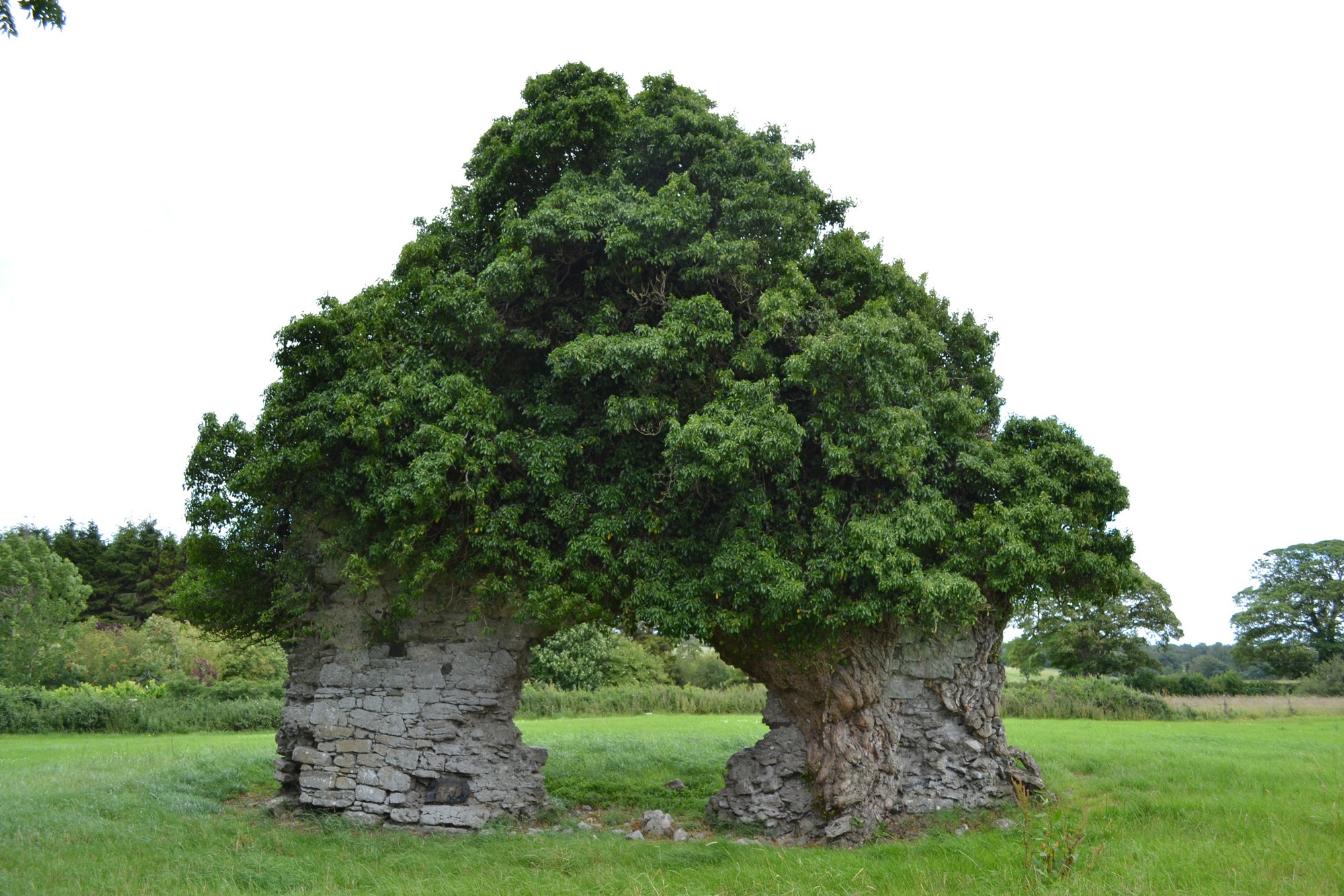
Site of graveyard contains ruins of medieval church. Marked on 1841 OS map as 'Tecolm Church (in ruins)'. Ruins overgrown and simply consist of west gable of wall c. 8m long. Church site associated with St Colman of Oughaval.
Graveyard contains no headstones or markers.
Graveyard has no upstanding boundary. Access to site across field. Church ruins visible but no visible surface trace of graveyard.