Sweetman, P.D., Alcock, O. & Moran, B. (1995) Archaeological inventory of County Laois. Dublin. Dublin Stationary Office, 87
O'Hanlon, J. Rev. & O'Leary, E. Rev. (1907) History of the Queen's County. Sealy, Bryers and Walker, vol 1 301
Comerford, Rev. M. (1886) Collections relating to the Dioceses of Kildare and Leighlin. Dublin, Duffy, vol 3, 132
Record of Monuments & Places, Co. Laois compiled by Caimin O'Brien (2007)
Redmond, N.T. (1997) Grave Inscriptions, Killeshin, Sleaty, Graiguecullen, Mayo, Arles, Doonane, Castletown, Rathaspick, Shrule, Rathnure etc., with Historical Notes, Rosmore Killeshin Development Association (RKDA), 14, 87
National Inventory of Architectural Heritage (NIAH), Co. Laois (1997)


The graveyard is rural area, in farmland.
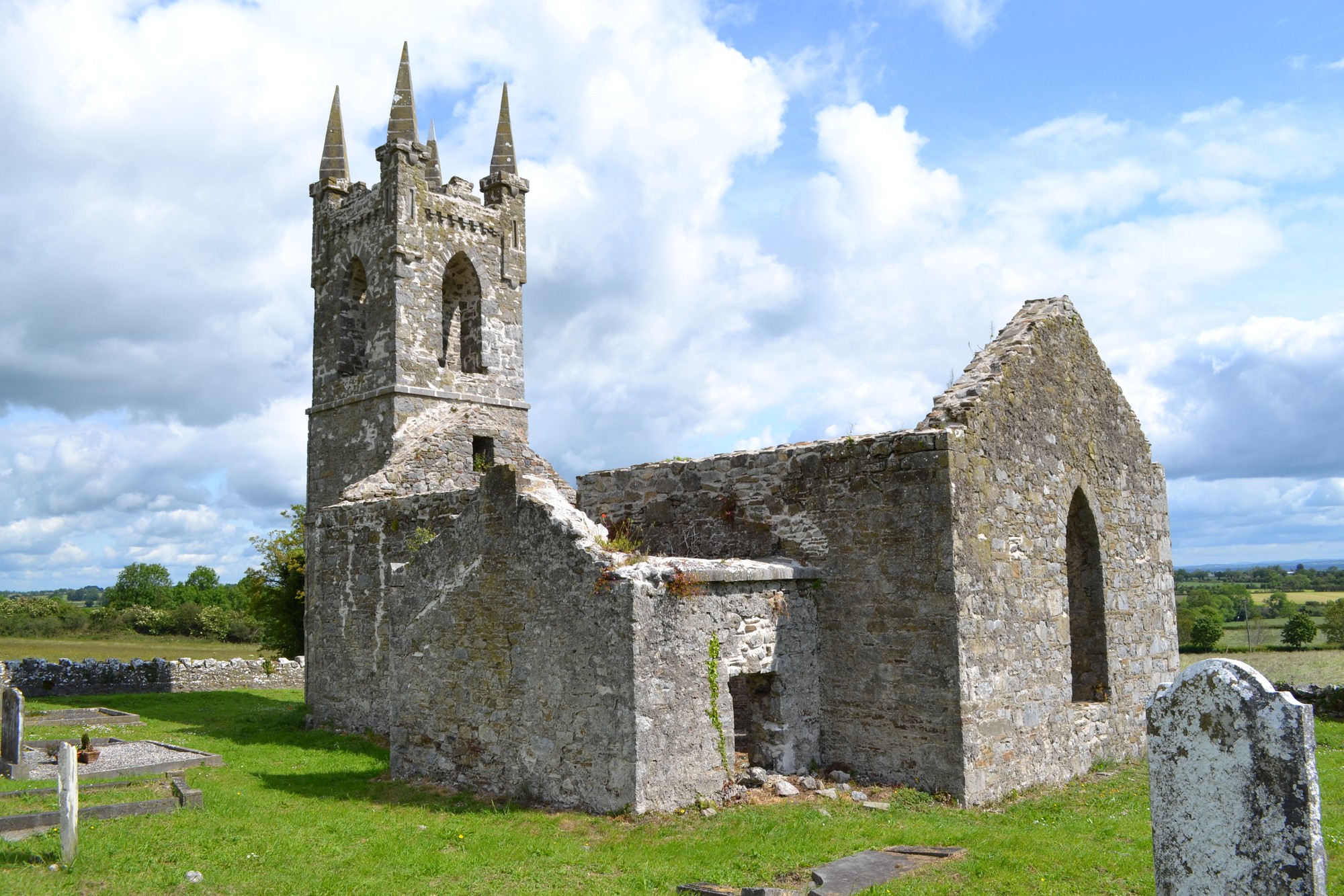
Graveyard contains the ruins of a Church of Ireland church built 1813. Possibly near/on site of earlier church. No visible surface trace of possible earlier church; earlier church may have been pulled down to supply stone for later church; marked on 1841 OS map as 'Church (in ruins)'. Ruins measure c. 17m by 9m. A holy well (no visible remains) and a souterrain (no visible surface trace) are located outside graveyard.
Graveyard contains mainly 19th to 21st century headstones in varying conditions; some of upstanding headstones are leaning, many of which are worn and otherwise damaged; a number of 19th century table tombs located north of the church.
Graveyard has D-shape; boundary stone wall intact but slightly overgrown some places. No paths; access via gate and stile Ground surface generally level. Ground well maintained; grass mown regularly.