National Inventory of Architectural Heritage code:
Register of Burials available:
Location of Published Local References:
Location of Inscriptions:
Titles of Published Local References:
Sweetman, P.D., Alcock, O. & Moran, B. (1995) Archaeological inventory of County Laois. Dublin. Dublin Stationary Office, 72
Record of Monuments & Places, Co. Laois compiled by Caimin O'Brien (2007)
National Inventory of Architectural Heritage (NIAH), Co. Laois (1997)
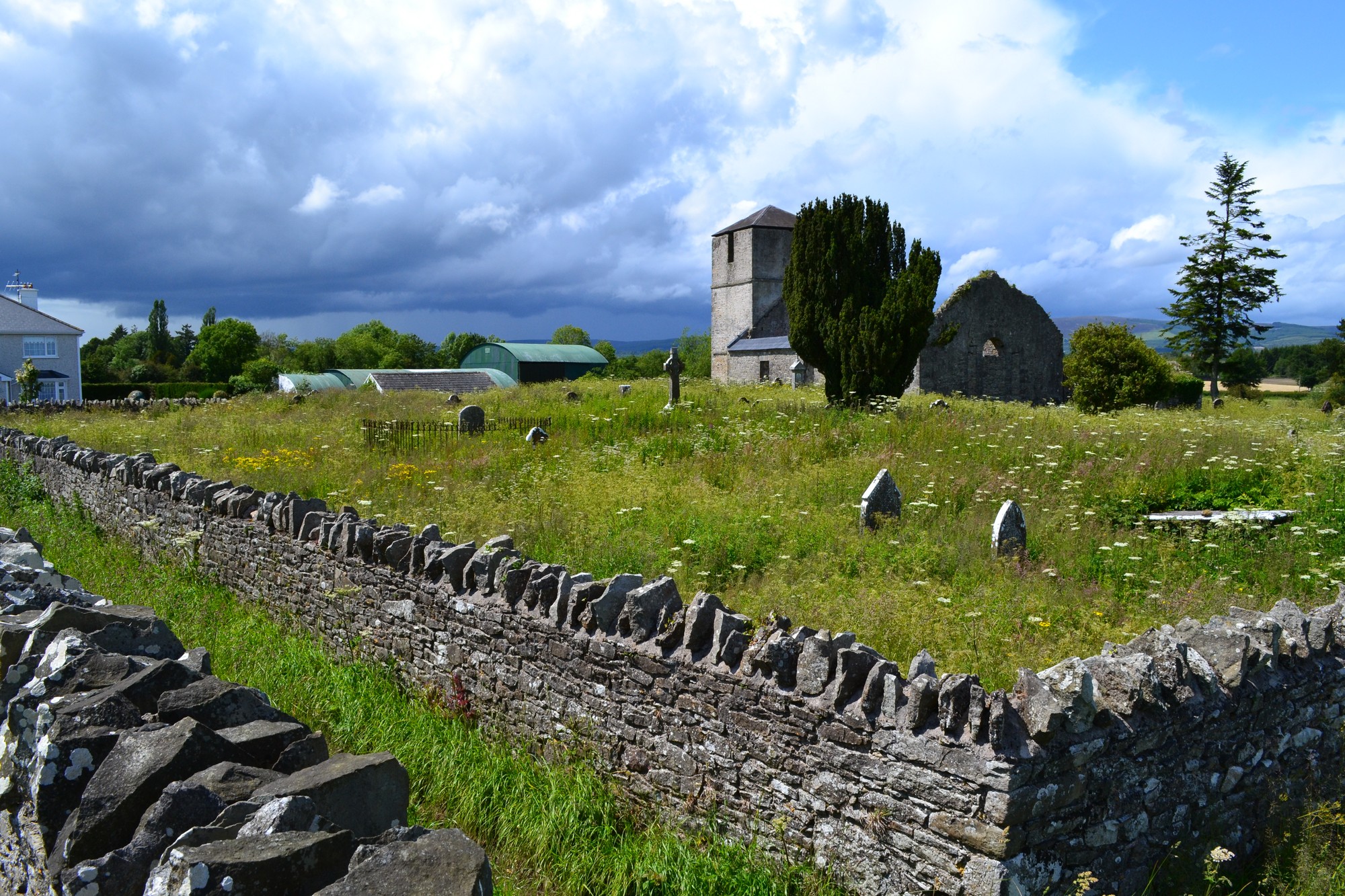


The graveyard is in rural area surrounded by pasture land, on east side of village of Coolerain., adjacent to later 19th century church and graveyard.
Graveyard contains ruins of a Church of Ireland church (late medieval church, rebuilt c. 1730) with tower, marked on 1841 map as 'Anatrim Church (in ruins)'. The church ruins measure approximately 17m by 7m. Church tower has recent new roof. This site is reputedly the site of an earlier foundation established in late 6th century by St Mochaemhog. St Kaban's Well lies about 130m to the north-northwest.
Graveyard heavily overgrown contains visible headstones dating from 18th century ; mausoleums, table tombs, grave railings and recumbent markers. Interior of church contains mausoleums.
Graveyard has rectangular shape; boundary stone wall c. 2m. Small concrete path from gate to interior of church ruins. Some recent repairs to part of the roadside stone wall; one entrance blocked, another repaired with new gate. Located beside roadside however access very difficult due to heavy overgrown nature of ground.