Sweetman, P.D., Alcock, O. & Moran, B. (1995) Archaeological inventory of County Laois. Dublin. Dublin Stationary Office, 85
O'Hanlon, J. Rev. & O'Leary, E. Rev. (1907) History of the Queen's County. Sealy, Bryers and Walker, vol 1 272
Comerford, Rev. M. (1886) Collections relating to the Dioceses of Kildare and Leighlin. Dublin, Duffy, vol 3, 280-281
Record of Monuments & Places, Co. Laois compiled by Caimin O'Brien (2007)
Cosby, A., Chairperson, (1989?) Stradbally, Co. Laois, Stradbally Historical Project, J.P.F. Laois, 61-2
Journal of the Association for the Preservation of the Memorials of the Dead, Ireland, 'Queen's County', (1909) 662-665


The graveyard is in rural area, surrounded by pasture fields.
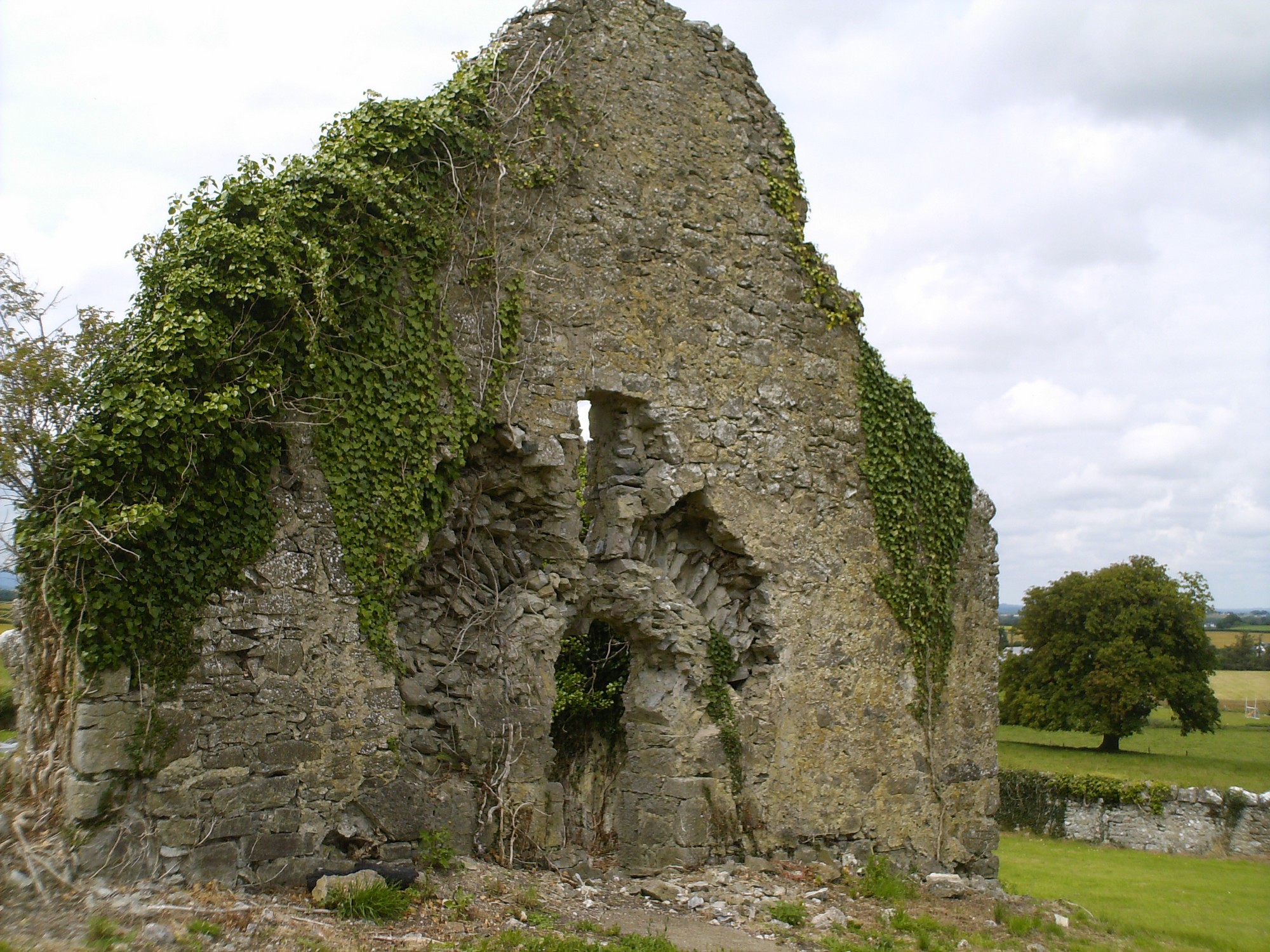
Graveyard contains ruins of medieval church marked on 1841 OS map as 'Kilteale Church (in ruins)'. Possibly associated with St Tiedil. Church used for Protestant service in 17th century. Ruins overgrown, measuring c. 13m by 8m; consist of east gable with arched doorway, north wall and south walls.
Graveyard contains 18th to 20th century headstones , celtic style crosses, metal crosses and recumbent slabs; many leaning, collapsed, worn or overgrown. A substantial number of small uninscribed markers within graveyard.
Graveyard has D-shape; boundary stone wall mostly intact, c. 1.5m high. No paths; access to through gate and stile from roadside. Ground level higher within than without; ground surface uneven due to concealed features. Graveyard maintained; grass mown fairly regularly except to east of church ruins.